St. Paul's development started along the Mississippi bluffs, and those same sedimentary layers define the challenges we face today when cutting into the ground for parking garages, utility corridors, or building foundations. The city sits on a complex sequence of Ordovician and Cambrian sedimentary rock, capped with glacial drift that can change thickness dramatically within a single block. Over the past decade, the surge of transit-oriented projects along the Green Line corridor has pushed excavation limits deeper, often right next to century-old masonry structures where differential settlement isn't an option. What used to be a simple trench box operation now requires continuous, real-time data to keep the excavation stable and the neighboring buildings intact. We've found that pairing our instrumentation with a thorough CPT test during the pre-construction phase gives us a baseline that makes the monitoring data far easier to interpret when things start moving. And for sites near the river where soft alluvial layers appear, the slope stability analysis often drives the shoring design we end up monitoring.
In St. Paul's layered drift and shale, the difference between a stable cut and a problem starts at the bedrock interface—that's where our instruments live.
Service characteristics in St. Paul
Risks and considerations in St. Paul
The geotechnical contrast between the West Seventh neighborhood and the bluffs along Shepard Road illustrates the risk spectrum we deal with. West Seventh sits on a thicker package of glacial lake sediments—compressible silts and clays that consolidate under the stress relief of an excavation. Shepard Road, closer to the river, has shallow bedrock but faces slope stability concerns tied to Mississippi River bluff recession, a natural process that accelerates when excavation removes toe support. In West Seventh, the primary risk is settlement of adjacent wood-frame homes built on shallow footings; we've seen cases where an unmonitored cut of 15 feet produced an inch of settlement 40 feet from the wall line. On the bluffs, the concern shifts to rotational slope failure if the shoring doesn't extend deep enough into competent rock. Local contractors sometimes underestimate how quickly the Platteville limestone can weather when exposed to air and moisture during a long open-cut period. A well-designed monitoring program that combines inclinometers, vibration sensors for nearby historic structures, and regular visual inspections by a geotechnical engineer catches these problems before they become structural failures.
Our services
Our monitoring scope adapts to the excavation depth, adjacent structures, and the site's geologic profile. These two core services cover most St. Paul projects.
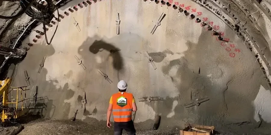
Deep Excavation Instrumentation
Full instrumentation package for cuts exceeding 12 feet or near sensitive structures. Includes inclinometers, load cells on tiebacks, optical survey targets, and automated data collection with daily reporting.
Vibration and Settlement Monitoring
Targeted monitoring for urban excavation near historic masonry buildings, churches, and residential properties. We install crack monitors, settlement points, and seismographs to document pre-construction conditions and track changes throughout the cut sequence.
Common questions
What triggers the need for excavation monitoring in St. Paul?
The Minnesota State Building Code, referencing IBC 2021 Section 3306, requires a monitoring program when an excavation exceeds 12 feet in depth or when adjacent structures are within a distance equal to the excavation depth. In practice, we also recommend monitoring for shallower cuts if the adjacent buildings are unreinforced masonry, which is common in St. Paul's older neighborhoods like Summit-University and Dayton's Bluff. The building official typically reviews the geotechnical report and may impose monitoring as a permit condition.
How much does excavation monitoring typically cost for a St. Paul project?
For a standard deep excavation in the downtown area with inclinometers, load cells, and survey monitoring, the cost generally falls between US$790 and US$2,850 depending on the number of instrument locations, the duration of monitoring, and the reporting frequency. A shallower residential cut with only settlement points and crack monitors will be at the lower end of that range.
How do you handle monitoring during winter conditions?
Minnesota winters present real challenges—frozen ground can mask settlement, and optical survey equipment needs protection from snow and condensation. We use heated enclosures for data loggers and schedule readings during daylight hours when temperatures are more stable. Inclinometer casings are installed below frost depth, so the subsurface data remains reliable. We also account for thermal contraction of shoring elements in our baseline readings, a detail that matters when steel soldier piles can contract noticeably at -20°F.
Can monitoring data help if a damage claim arises from a neighboring property owner?
Absolutely. Pre-construction condition surveys and continuous monitoring data provide an objective record that shows whether the excavation actually caused the claimed damage or if the cracks were pre-existing. This documentation has resolved disputes without litigation on several projects we've worked on near Irvine Park and other historic districts where property owners are understandably protective of their buildings.